account arrow-down arrow-left arrow-right closecontact-us emailFacebookheart instagramjoin linkedin phonepinterestplaysearch twitteryoutube

Llangollen Canal

The Llangollen Canal features the Pontcysyllte Aqueduct – the highest and biggest in the British Isles – another aqueduct at Chirk and no less than three tunnels, plus spectacular scenery.

Map of the Llangollen Canal and surrounding waterways

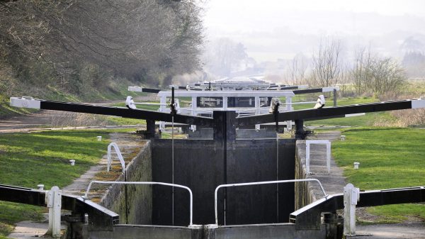
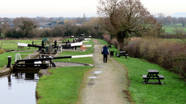
Hurleston lock flight

About the Llangollen Canal

The Llangollen Canal is one of the most popular holiday inland waterways and can become very busy during the summer months.  It is rightly famous for the 1007-foot long Pontcysyllte Aqueduct towering about the Dee Valley, but the whole of the Welsh section offers some of the most scenic views from a UK canal.  The canal had a complicated construction, but was largely opened by 1806 and became moderately successful in economic terms.  It was taken over by rail companies and traffic dwindled to almost nothing prior to the Second World War.  The Canal was abandoned in 1944, and the then Shropshire and Denbighshire county councils put forward plans to drop road bridges in 1949.  The waterway was kept open as a water supply and the developing leisure interest of the 1950s saw its revival.

Facts and Stats
Pontcysyllte Aqueduct
Waterway Notes
Facilities for Boaters
Notes for Visitors
History – Building the Canal
History – Expansion
History – Fall and Rise
Llangollen Canal connections
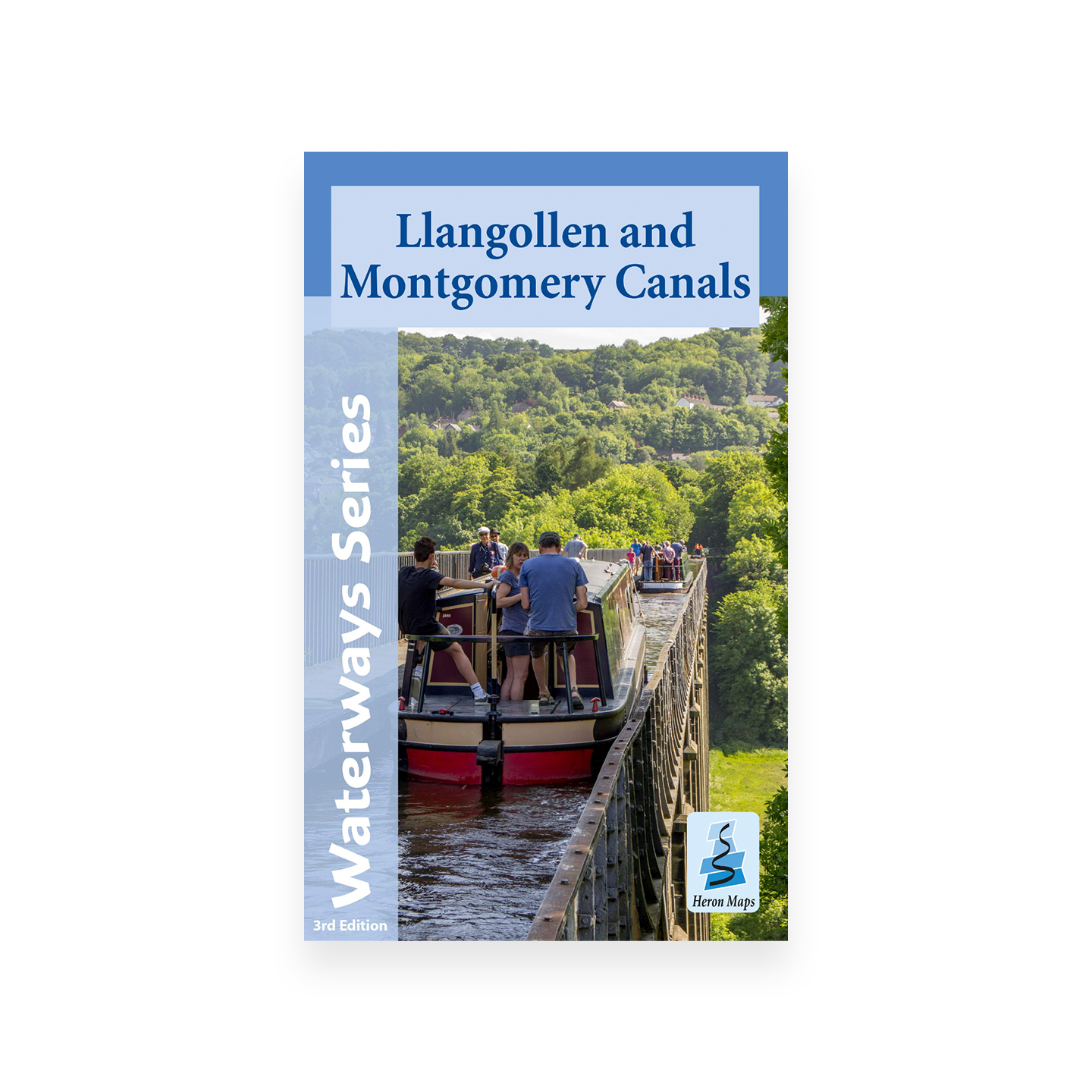
Llangollen Canal maps and guides

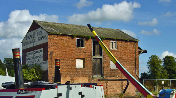
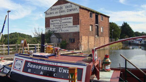
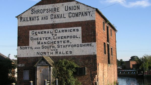
The name ‘Llangollen Canal’ is a relatively new one for what was for many years known as the ‘Ellesmere Canal’ and the ‘Welsh section’ of the Shropshire Union Canal.  The new name only became used once the route with the opening up of leisure traffic in the 1950s after becoming all but derelict, having been kept open just for water supply, despite being legally abandoned in a 1944 Act of Parliament.  An early, possibly the earliest, printed use of the name ‘Llangollen Canal’ is in a November 1951 edition of a British Waterways staff magazine.

[The photo shows a boat on the narrow feeder section of the Llangollen Canal above Trevor  –  by Sue O’Hare]

Facts & Stats

46 miles

(74.0 km)

The length of the main line of the Llangollen Canal, from Hurleston Junction to Llantysilio

21 locks

Including a staircase (2 locks) at Grindley Brook

1806

Year opened

The line from Trevor to Hurleston Locks was open to through traffic in 1806.  The water feeder from Llantysilio opened in 1808.

Pontcysyllte Aqueduct

The work of Thomas Telford and William Jessop, the aqueduct is a Scheduled Ancient Monument, a World Heritage Site and a Grade 1 listed structure, a Waterways Wonder and one of the Wonders of Wales.

The aqueduct was originally planned as a much lower masonry structure, with flights of locks down from Trevor and up the other side, which would have created water supply issues.  William Jessop suggested the design as built, but there is much debate as to whether it was Jessop or Telford who was behind the technical brilliance of its construction.

The aqueduct still carries over 50 million litres of water each day to supply water to southern Cheshire, and is a major tourist attraction.

[The photo shows the aqueduct  –  by Robert Silverwood]

Waterway notes

Maximum sizes

The maximum size of boats than can travel on the Llangollen Canal are:

  • Length: 73′ 10″ (22.51 metres) – Grindley Brook locks
  • Width: 7′ 0″ (2.13 metres) – Hurleston Bottom Lock
  • Headroom: 7′ 0″ (2.13 metres)
  • Draught: 3′ 11″ (1.2 metres) – cill of Grindley Brook lock

Above Trevor, the canal shallows, and boats with a draught of more than 2′ 9″ (0.84 metres) will struggle, though historic narrow boats with a draught of 3′ 0″ (0.91 metres) have reached Llangollen.

All but the smallest and shallowest of craft should turn at the mooring basin at Llangollen, above bridge 45.

Useful Info

  • A Sanitary Station key is required for Bridge 20 (Wrenbury Lift Bridge – electric)
  • In its commercial days, the main line of the canal was considered to go to Llanymynech, with the route to Llangollen from Frankton Junction being considered a branch – so the bridge numbering starts from Hurleston bridge (no 1), carries on to Frankton (no 69), and then onwards down the Montgomery Canal to Llanymynech (no 92).  The bridge numbers west of Frankton Junction then started again at Nicholas Bridge (no 2) and carry on to Kings Bridge at Llantysilio (no 49A).
  • Neither Chirk nor Whitehouses tunnels are wide enough for boats to pass; likewise Pontcysyllte and Chirk aqueducts.  The aqueducts are 126 foot and 70 foot, respectively, above the rivers Dee and Ceiriog.

Navigation Authority

Facilities for Boaters

Above Hurleston Locks – Sanitary Station and waterpoint
Above Bridge 6 (CW5 8NR) – Swanley Bridge Marina (boatyard)
Below Bridge 20 (CW5 8HG) – Wrenbury Mill (boatyard)
Above Grindley Brook Locks – Sanitary Station, waterpoint and pump-out
Above Bridge 31A (SY13 3AA) – Whitchurch Marina (boatyard)
Prees Branch (SY13 2QS) – Whixhall Marina (boatyard)
Below Bridge 58 (SY12 9DD) – Blackwater Meadow Marina
Above Bridge 58 (Ellesmere Yard) – Sanitary Station
Above Bridge 12 (New Marton) – Water Point
Below Whitehouse Tunnel (LL14 5AD) – Chirk Marina (boatyard)
Above Bridge 29 (LL20 7TX) – Canal Wharf Trevor (boatyard)
Below Bridge 45 – Water Point
Above Bridge 45 – Sanitary Station and Water Point

[The photo shows boats on the Llangollen Canal, next to Blake Mere  –  by Chris Handscombe]

Notes for Visitors

Walking and Cycling:  There is a towpath throughout the length of the Canal.  Follow the Towpath Code.

Canoeing and Paddleboarding: Canoeing is encouraged on the Llangollen Canal with a Canal & River Trust licence or British Canoeing membership.

Boat Trips:
Llangollen Wharf – horse drawn trip boats; motorised trip boats over the Pontcysyllte Aqueduct.
Anglo-Welsh – Little Star boat trips over the Pontcysyllte Aqueduct.
Vale of Llangollen Canal Boat Trust – Community Boat for disabled and disadvantaged people.

Day Boat Hire:
Whittington Wharf: The dayboat Dolphin (hired by the day)
Llangollen Wharf: Boats to hire by the day, with or without a skipper.
Anglo-Welsh – Day boats available from their bases at Whixhall and Trevor
Blackwater Meadow (ABC) – Day boat, near Ellesmere
Whitchurch Marina (ABC) – Day boat, near Whitchurch

Nearby Rail Stations: Wrenbury, Whitchurch, Chirk, Llangollen (Heritage Railway)

[The photo shows Wrenbury Mill –  by Robert Silverwood]

Building the Canal

What we now call the Llangollen Canal was constructed in stages by the Ellesmere Canal Company as part of a planned network of waterways linking the River Mersey at Ellesmere Port, formerly a small fishing village called ‘Netherpool’, on the Wirral to the River Severn at Shrewsbury, and with the coal mines of the Ruabon area (near Wrexham) and the limestone quarries around Llanymynech on the Welsh border.  The Act authorising construction was passed in 1793 as part of ‘Canal Mania’, when many ambitious canal schemes were approved on a wave of investors clamouring to put their money into the latest get-rich-quick fashion.

The Chester Canal Company had already built (opened in 1779) a canal from the River Dee in Chester to Nantwich.  The first part of the Ellesmere Canal Company’s canals to be built was the Wirral line, connecting Chester to Ellesmere Port, which opened in 1795.  Work started simultaneously on several parts of the planned network, but next to open was the section between Llanymynech and the bottom of Frankton Locks, opened as an isolated section in 1796.  A connection between the Chester Canal and the Wirral Line followed in 1797.

[The photo shows a lift bridge at Whixhall on the Llangollen Canal  –  by Alan Stopher]

Expansion

1797 also saw the opening of about 6 miles of canal, from the bottom of Frankton Locks to Weston – part of the intended line to Shrewsbury, but this section never progressed further, as the Shrewsbury Canal had already reached the town and the upper Severn was considered a poor navigation and unlikely to produce through trade.  The next section to open was that from Trevor (near Ruabon) to Frankton, completed in 1805 with opening of the Pontcysyllte Aqueduct.  The 29-mile section from Frankton to Hurleston Junction on the Chester Canal, opened in 1806.  As construction of a planned canal extending to the Dee from Trevor had been abandoned, a navigable feeder was then made to connect to the Dee as a water supply at Llantysilio to Trevor, which opened in 1808.  This water supply now feeds the whole Llangollen Canal and onto the Shropshire Union Canal, and became the crucial factor that saved the canal for use today.

These waterways comprised a self-contained network, as the Middlewich Branch (connecting to the Trent and Mersey Canal) and the southern half of the Shropshire Union Canal (then known as the Birmingham and Liverpool Junction Canal), connecting to the Staffordshire and Worcestershire Canal, and then to the Birmingham Canal navigations, had yet to be built.  The Chester Canal Company had intended to build a line to Middlewich at the same time as its line to Nantwich, but had run out of money, and the Trent & Mersey Canal Company had refused them a connection anyway.  The Ellesmere and Chester canal companies were mutually dependent on each other’s waterways, and after 9 years of talks, a merger was agreed in 1813.  Opening of the Birmingham and Liverpool Junction Canal in 1835 brought more traffics to the merged company’s canals.  Perceiving a threat to its trade when construction plans were announced, the Trent & Mersey Canal Company had relented and permitted a connection at Middlewich, and the Ellesmere and Chester’s branch to the town was opened in 1833.

[The photo shows a trip boat outside Llangollen Wharf  –  by Edd Leetham]

Fall and Rise

The Ellesmere & Chester and the Birmingham & Liverpool companies merged in 1845 to form the Shropshire Union Canal Company, which a year later merged with Shropshire rail interests with a plan to close canals and build railways on the canal beds.  However, almost immediately the operations of this combined company were leased to the London & North West Railway, which prevented the planned railway building and the waterway interests were developed, especially where they were in the territories of rival rail companies.  Competition from rail, and then roads, took its toll and gradually many of the company’s canals were left to decay, though there remained viable traffics on the Ellesmere and Llanymynech lines until the 1936 when a breach below Frankton locks led to abandonment of the Llanymynech line, by which time the company had been fully bought out by the London & North West Railway in 1922, and absorbed into the London Midland and Scottish Railway in 1923.  The latter gained legal abandonment of all the Shropshire Union system west of Hurleston Junction in 1944, but the line to Llantysilio was kept open because it was a water feeder to the main Shropshire Union line.

Growing leisure traffic and a 1955 water supply agreement with the Mid & South East Cheshire Water Board secured the future of the line, which became known as the ‘Llangollen Canal’, and has  since become one of the busiest canals on the UK inland waterway network, with visitors attracted by the spectacular scenery and outstanding industrial architecture, mostly notably the Pontcysyllte and Chirk aqueducts.

[The photo shows a busy scene, at the junction with the Ellesmere Arm  –  by Alan Stopher]

Llangollen Canal Connections

The Llangollen Canal runs from the Shropshire Union Canal (the part that was originally the Chester Canal) at Hurleston Junction to Llantysilio Bridge just beyond Llangollen, where water feeds in over Horseshoe Falls from the River Dee.  The Llangollen Canal also links to the Montgomery Canal (originally the Llanymynech line of the Ellesmere Canal) at Frankton Junction.

There are three arms, none with any locks:

  • Ellesmere Arm – open – 0.25 miles (0.4km) – completed in 1804.
  • Prees Branch – restored for 1.5 miles (2.4km) and 2.0 miles (3.2km) derelict.  The Arm was intended to reach Prees, but never did, stopping short at Quina Brook on the Whitchurch to Wem road in 1806
  • Whitchurch Arm – restored for 0.25 miles (0.4km) and 0.75 miles (1.2km) proposed for restoration – completed in 1811.

The Plas Kynaston Arm, of just over half a mile, was built privately from Trevor to Plas Kynaston, opening in 1830 and in use for commercial traffic until after World War I.  From then, the small branch was used as a water supply to local industry, but when the feeder arm between Trevor and Llantysilio breached in 1945, alternative water supplies were found and the Arm was allowed to go derelict.  Plas Kynaston Canal Group formed in 2010 to promote restoration of the Arm and regeneration of the area.

[The photo shows the horse bridge at the Junction of Llangollen and Shropshire Union canals (actually on the latter canal)  –  by Derek Smith]

Funding of Canal & River Trust waterways

IWA was instrumental in Canal & River Trust receiving a sufficient funding package from Government when the new charity was set up in 2012 to run the waterways previously managed by British Waterways.

Waterways Heritage at Risk

Britain’s canals and rivers are a unique, living heritage. But that heritage is at risk – from urban development, lack of protection, loss of skills and knowledge and climate change.

You can help Save Waterways Heritage.

Sustainable Boating

We want boating on canals and rivers to be more sustainable and – even though the current overall contribution to UK carbon emissions is very small – we want to help reduce emissions on the waterways.

Waterway restoration

Restoring the UK’s blue infrastructure – our inherited network of navigable canals and rivers – is good for people and places.

Waterway underfunding

Hundreds of miles of waterways – along with their unique heritage and habitats – are currently starved of funding and rely on constant lobbying by us to safeguard their future.

Sustainable Boating

We want boating on canals and rivers to be more sustainable and – even though the current overall contribution to UK carbon emissions is very small – we want to help reduce emissions on the waterways.

Waterways Heritage at Risk

Britain’s canals and rivers are a unique, living heritage. But that heritage is at risk – from urban development, lack of protection, loss of skills and knowledge and climate change.

You can help Save Waterways Heritage.

Waterway restoration

Restoring the UK’s blue infrastructure – our inherited network of navigable canals and rivers – is good for people and places.

Local activities