account arrow-down arrow-left arrow-right closecontact-us emailFacebookheart instagramjoin linkedin phonepinterestplaysearch twitteryoutube

Shugborough and the Staffs & Worcs Canal Walk

Walk the Staffs & Worcestershire Canal at Shugborough, featuring Tixall Lock and Tixall Wide. The walk can be started at any point where there is convenient parking, but the description assumes the start is from Milford Common.

Walk

Branch
IWA Lichfield Branch
Distance

6.9km (4.3miles)

Ease

Leisurely

activity image

A very pleasant 4.3 mile walk taking in parts of the Shugborough estate and the towpaths of the Staffs & Worcs and Trent & Mersey canals. It is mostly flat apart from the section through the Satnall Hills at the end where there is some fairly gentle uphills and some steeper downhills, be careful on the downhill sections.

Walk details

Parking

There is one car park on the Common (pay and display) and several places where parking can be found with no charge.

Toilets

Great Haywood Farm Shop and Café with toilet facilities is a short distance from the junction of the Staffs & Worcs and the Trent & Mersey Canals on the other side of the road seen to the left from the junction.

If you are National Trust members there are two cafes and several toilet facilities within Shugborough Park.

Shugborough and the Staffs & Worcs Canal Walk Map

Find directions to the Activity

Begin The Walk

1. Milford Common

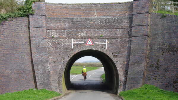
From Milford Common look for the entrance to the National Trust property Shugborough and take the road to the left of the entrance (Holdiford Road). Walk on the pavement on the left of the road and follow this up and over the railway bridge and down to the river bridge. At this point the pavement disappears so cross the river bridge carefully, it is a narrow bridge, and the traffic can be busy at times. Continue a short distance up the road to the next bridge watching out for the traffic and take the path on the left of the bridge down onto the canal towpath. The bridge is Number 106 “Tixall Bridge”.


2. Tixall Lock and Tixall Wide

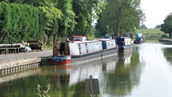
Turn right and follow the towpath past Tixall Lock and Tixall Wide. As you go through Tixall Wide look out for the elegant building on the other side of the Wide across the fields. This is Tixall Gatehouse, once the gatehouse to Tixall Hall. The original Hall was built in 1555 and demolished in 1927/8 with the Gatehouse being built slightly later in 1580 and this has been refurbished as a holiday let run by the Landmark Trust. The mostly likely theory for the creation of Tixall Wide is that it was dug at the instigation of the Clifford family who owned TIxall Hall at that time in order to provide the Hall with a beautiful view.

The next bridge is called Swivel Bridge although there is no evidence that it has ever been anything other than a brick accommodation bridge. Passing some permanent residential moorings and an Anglo Welsh hire base you will soon arrive at the junction of the Staffs & Worcs and Trent & Mersey Canals with its very elegant bridge.

3. The Trent

At the canal junction go under the bridge and turn right, the fingerpost points the way to “The Trent”. Just past the next lock go down and under the bridge and turn sharp right and then left onto the path that has just crossed the bridge. This leads onto Essex Bridge, a narrow pack horse bridge that originally dates from the 16c. It used to have many more arches than the current eighteen and in its current form dates from 1817 but was originally much older.

4. Shugborough Park

The bridge leads onto the bridleway across Shugborough Park where there are good views of Shugborough Hall, the ancestral home of the Anson family, Earls of Lichfield. If you are National Trust members you may go through the gate into the Park and either visit the House or make use of the cafes and toilet facilities. Either way you will end up at the visitor centre at the other end of the bridleway.

5. Satnall Hills

At this point follow the exit road up and over the railway bridge, round to the right and where the road curves left go through a gate into the Satnall Hills. The woodland path here is marked by an orange waymark. You will soon come to a fork in the path, take the left fork, again marked by an orange waymark, and follow the path first fairly steeply up and then fairly steeply down to a gate. Go through the gate and turn right and follow the wide track up the hill along the fence line and through the trees.

6. Rugeley Road

At the top of the hill is Satnall Reservoir and the waymarked path goes through a gate to the right. Ignore this and follow the wide track to the left and around the reservoir. This will then turn into a wide footpath going downhill through the trees back to the Stafford to Rugeley road at a small layby. Turn right onto the pavement and you will arrive back at the starting point of Milford Common.

Explore Nearby

Related activities

Waterway underfunding

Hundreds of miles of waterways – along with their unique heritage and habitats – are currently starved of funding and rely on constant lobbying by us to safeguard their future.

Sustainable Boating

We want boating on canals and rivers to be more sustainable and – even though the current overall contribution to UK carbon emissions is very small – we want to help reduce emissions on the waterways.

Waterways Heritage at Risk

Britain’s canals and rivers are a unique, living heritage. But that heritage is at risk – from urban development, lack of protection, loss of skills and knowledge and climate change.

You can help Save Waterways Heritage.

Waterway restoration

Restoring the UK’s blue infrastructure – our inherited network of navigable canals and rivers – is good for people and places.