account arrow-down arrow-left arrow-right closecontact-us emailFacebookheart instagramjoin linkedin phonepinterestplaysearch twitteryoutube

Horseway Lock, Middle Level Navigations

Accessible to all craft kept on the connected inland waterways

Silver Propeller Challenge

Location

Chatteris, Cambridgeshire

Visit Horseway Lock on the Middle Level Navigations by boat or canoe.

It has been chosen as a Silver Propeller Location to aid the ongoing IWA campaign for the restoration of this lost route.  A photo of your boat at Horseway Lock would be the best proof of your visit.  However, as it is not possible to turn at Horseway Lock, a photo at Sixteen Foot Corner will also suffice as proof. 

Complete our challenge by visiting 20 locations from our list, you will receive our exclusive plaque and goody bag.

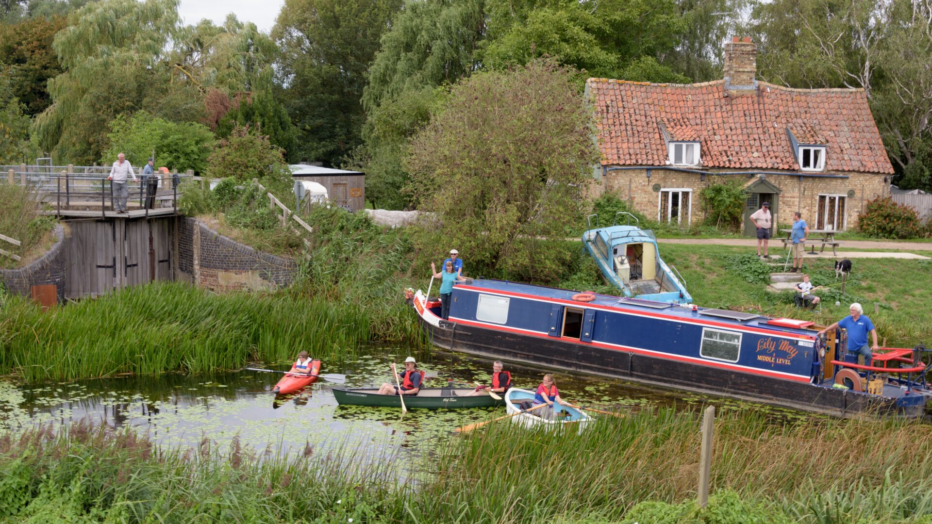
About the Middle Level Navigations and Horseway Lock

The Middle Level Navigations are a network of waterways between the Rivers Nene and Great Ouse.  Most of the area through which they run is at or below sea level, and carried out attempts to protect it from inundation since 1480.  The Dutch Engineer Cornelius Vermuyden proposed an improved drainage scheme in 1642 which divided the area into three zones; the North Level, the South Level and in between, the Middle Level.  Although drainage is primarily the use of the Middle Level as it encompassed natural waterways already used for navigation, water levels were always managed to allow navigation.  Establishing commissioners in 1754 helped to maintain the waterways and collect tolls from commercial traffic.

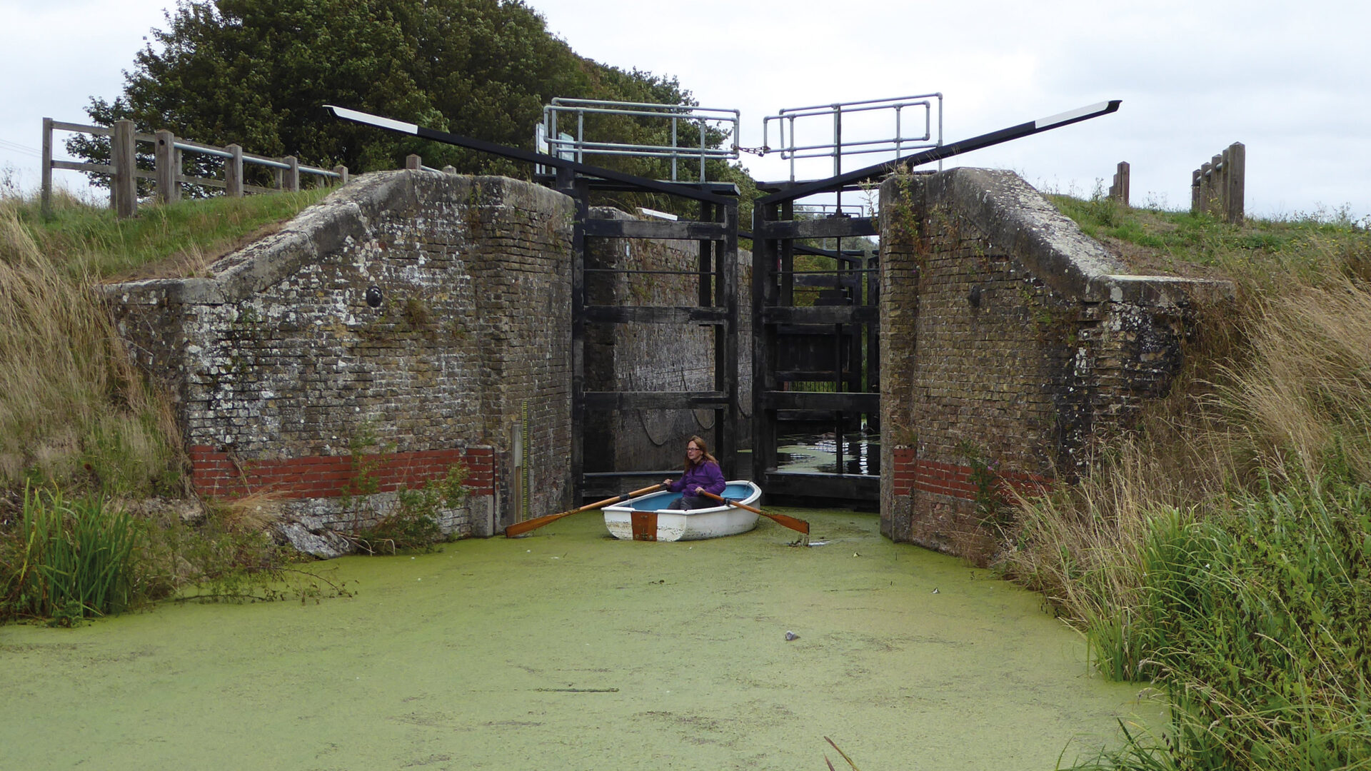
Horseway Lock (also known as Horseway Sluice) is on the Forty Foot Drain (also known as Vermuyden’s Drain), ¾ mile from Sixteen Foot Corner; the junction with the Sixteen Foot Drain.  This is little used as the channel between Horseway Lock and the Old Bedford River is dry and Welches Dam has been closed by the Environment Agency.  Before the restoration and reopening of Well Creek in 1975, this was the only route through the Middle Level to Denver Sluice.

[The photo shows Horseway Lock on the Middle Level Navigations  –  by Alison Smedley]

Notes for visitors

Location

Postcode: PE16 6XU

What3words /// goodness.described.remark


Middle Level Navigations Dimensions

The maximum size of boat that navigate most areas of the Middle Level is:-

  • Length: 80′ (24.4m)
  • Beam: 11′ 6″ (3.5m)
  • Height: 6′ 6″ (1.98m)
  • Draught: 3′ (0.9m)

Although Stanground Sluice is 80ft long, boats over 72ft are likely to have difficulty negotiating Briggate Bend in Whittlesey.  Deep-draughted boats need to be positioned with care in Stanground Sluice Some bridges in the south west corner of the Navigations have a height of little more than 5 foot – see the table here.  There is no winding hole at the lock.

Canoeing & Boat Hire

The Middle Level Commissioners welcome canoeists on their waterways, for which a licence is required for non-members of British Canoeing.

There are no trip boats or day boat hires in the vicinity.

Challenge Location

Horseway Lock

Vermunden’s Drain or Forty Foot River, Middle Level Navigations

Discover more nearby

Related activities

Waterway underfunding

Hundreds of miles of waterways – along with their unique heritage and habitats – are currently starved of funding and rely on constant lobbying by us to safeguard their future.

Sustainable Boating

We want boating on canals and rivers to be more sustainable and – even though the current overall contribution to UK carbon emissions is very small – we want to help reduce emissions on the waterways.

Waterways Heritage at Risk

Britain’s canals and rivers are a unique, living heritage. But that heritage is at risk – from urban development, lack of protection, loss of skills and knowledge and climate change.

You can help Save Waterways Heritage.

Waterway restoration

Restoring the UK’s blue infrastructure – our inherited network of navigable canals and rivers – is good for people and places.