account arrow-down arrow-left arrow-right closecontact-us emailFacebookheart instagramjoin linkedin phonepinterestplaysearch twitteryoutube

Caldon Canal Heritage Walk

Denford and the Hazelhurst Aqueduct are the central point for this figure-of-eight-shaped walk.

Walk

Branch
IWA North Staffordshire & South Cheshire Branch
Location

Denford

Distance

3.2km (2 miles) or 5.6km (3 1/2 miles)

Ease

Leisurely

activity image

On this self-guided walk, you will explore the history of the various changes of canal route in this area.

The Caldon Canal was built as a branch of the Trent & Mersey Canal following an Act of Parliament in 1776.  The main line of the canal was completed in 1778, with an extension through Froghall Tunnel to the current terminus being added a few years later. 

The Leek Arm was built in 1801 to bring water from the newly constructed Rudyard Reservoir to a newly lengthened summit level at Denford.  This involved building a new embankment across the valley of the Endon Brook and a new staircase flight of locks at the edge of Hazelhurst Wood to replace three separate locks between there and Endon. 

40 years later the staircase (having proved to be a bottleneck as John Rennie the Leek Arm engineer had warned) was abandoned and replaced by a flight of 3 new locks at Hollinhurst (the “New Hazelhurst Locks”).  Part of the original 1778 line of the canal was re-used and a new aqueduct built through the Denford Embankment, thus creating one of the six places in the UK where one navigable waterway crosses another.

Walk details

Parking

The walk starts outside the Holly Bush Inn at Denford. If parking here to go on this walk please ask permission to use car park, and make use of the excellent refreshments on offer on your return!  

Optional detour

Alternative parking can be found at Deep Hayes Country Park, in which case you will start the walk at point 11 below and then resume from point 1.  

Caldon Canal Heritage Walk

Find directions to the Activity

Begin the route

1. Holly Bush Inn

Standing on the canal towpath with the Holly Bush pub behind you, turn to the right and walk along the Caldon Canal towpath. Look out for the replica milepost, replaced in the 1980s by the then Caldon Canal Society (now Caldon & Uttoxeter Canals Trust). 

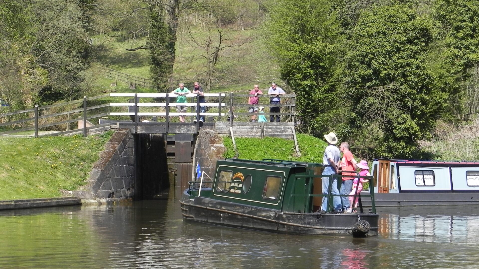
As the canal starts to turn to the right, you will see straight ahead of you the bottom of the staircase flight of locks which was the middle of the 3 arrangements of the canal in this area.  There is often an historic narrow boat moored half way into the lock chamber, which is all that remains in water. 

The woods beyond are Hazelhurst Wood, an ancient woodland which gave its name to the original staircase and hence the modern replacements further on the walk.

2. Hazelhurst Aqueduct (below)

Continue around the bend and under Hazelhurst Aqueduct – note the 1841 date stone on the aqueduct. This dates from the third and final re-arrangement of the canals in this area, and carries the 1801 Leek Arm, which crosses the valley on an embankment over both the original and later line of the canal. 

3. Bridge 37, Caldon Canal

Continue along the towpath to Hazelhurst Bottom Lock and the site of Bridge 37. Sadly the bridge had to be demolished in 2020 after it became unsafe. As it is Listed and in a Conservation Area the local IWA branch is hopeful that its replacement will be appropriate. In the meantime a rather unsightly scaffold bridge provides private access to the moorings on the offside. Below the bottom lock is a good example of a recently restored traditional wrought iron split bridge.  

4. Hazelhurst Locks

Walk up the gentle slope of the towpath alongside the rise of the three Hazelhurst Locks. These locks date from the 1841 re-alignment – the line of the original 1778 canal is now off to the right alongside the locks and is clearly visible in the winter time. 

Like the rest of the Caldon Canal down the valley from here, these locks were derelict by the 1960s and were reopened in 1974 after restoration.  The sideponds allowed half a lock full of water to be saved each time they were used (preserving more water for feeding the Trent & Mersey summit) but are unfortunately no longer useable. 

5. Bridge to the Leek Arm

At the third and top lock, cross over the black and white 1842 cast iron bridge to join the towpath of the Leek Arm of the canal (signposted Leek on the fingerpost).  As well as connecting the town of Leek to the canal system, the arm was built in 1801 to supply water from the newly built Rudyard Reservoir to the summit of the Caldon Canal.  As part of these works the summit level of the original 1778 canal was extended along the valley to Hazelhurst and a staircase of 3 locks built to replace the original locks towards Endon. 

6. Bridge 2, Leek Arm

Follow the towpath of the Leek Arm for half a mile (parallel to the route you took up the locks and heading back towards Denford). This is usually the muddiest part of the route so beware.  Bridge 2 is a lovely stone arch, typical of the bridges built by John Rennie as part of the 1801 Leek Arm and extended summit. 

7. Hazelhurst Aqueduct (above)

The canal skirts what remains of Hazelhurst Wood (and the quarry where stone for building the embankment came from), and then takes a left hand turn under a bridge (taking the towpath over the canal).  This was a T junction during the middle arrangement of the canal, with the original line (the now filled-in 1801 staircase) continuing straight ahead (you can see the stonework of the top lock entrance under the decking in the garden of the original lock keeper’s cottage).  

8. Bridge 4, Leek Arm

Turning left over the canal you will find yourself on the top of Hazelhurst Aqueduct, and above the route you took earlier.  A short cut back to the Holly Bush at this point (if you’ve had enough walking) can be found by going down the steps and along the towpath to the pub.

9. Bridge 5, Leek Arm

Continuing on along the Leek Arm takes you over two more aqueducts. The embankment built in 1801 to carry the Leek Arm and the water from Rudyard Reservoir is pierced three times, but only one of them dates from when it was built.  This is the culvert which carries the Endon Brook on its way to join the River Churnet. The second piercing was the 1841 canal aqueduct, and the latest, and third that you will walk over, was built in 1863 when an iron trough was added to carry the canal over the new North Staffordshire Railway branch line to Leek.  The row of cottages just beyond once included a pub. 

The towpath joins a canal-side track for a while, and when you get to Bridge 4 there is another opportunity for a short cut back to the Holly Bush by walking down the road.  Otherwise, continue along the towpath as the Leek Arm heads along the side of the valley. There are a number of delightful properties with canalside gardens to enjoy.

Passing under Bridge 5 there is a good view down the valley, including the Victorian brick water tower of the former St Edward’s Hospital at Cheddleton.  The canal widens out into a huge winding hole just before Bridge 6.  This was apparently dug out deeper than the rest of the canal to create a sump into which sediment in the water coming down the feeder could fall, to reduce dredging requirements further down the canal.  The brick overflow weir takes excess water from the canal and puts it into the Endon Brook via a culvert.

10. ‘Horse Bridge’, Leek Arm

Bridge 6 is known as Horse Bridge, although the original “horse bridge” is actually the bridge taking the road over the Endon Brook, which you will pass over by going up on to the road at this point and walking down the hill.  Watch out for any traffic on the road.  Just downstream of here the Endon Brook joins the River Churnet as it comes round Leek and down the valley towards Cheddleton. You will pass over the railway line on a recently restored bridge (with the old station house off to the left) and can then join the towpath of the main line of the canal at Bridge 39. 

11. Optional detour to Deep Hayes Country Park

At this point you have the option of a 1.75 mile detour around Deep Hayes Country Park.  Instead of going down on to the towpath, cross over the canal towards the Country Park entrance.   

The site of the former Wall Grange brickworks is ahead of you.  The manager’s house (to the left of the bridge with gardens going down to the canal) is all that remains of the various kilns, buildings, tramways and the 100ft high chimney that the brickworks comprised.  The quarry can be explored as a small detour to the left as you turn right into the entrance to the country park. A brick-laid path goes up to the top of the quarry and another small detour can be taken by following this path to the end of the brick surface and taking a flight of steps back down to the country park visitor centre.  

Once in the country park you can follow the path up one side of the three pools and back down the other, with two crossing points in between if you want a slightly shorter detour.  Deep Hayes pools were once a drinking water reservoir until it was drained and made into 3 separate pools in the 1970s.   

The reservoir was built by the Staffordshire Potteries Waterways Company, along with a pumping station a little further down the valley, to provide clean drinking water to the people of Stoke-on-Trent.  The original dam of the reservoir was at the site of the car park and visitor centre and was originally 15 metres high and 125 feet long.

12. Bridge 39, Caldon Canal

Back on the canal walk at Bridge 39 – cross back over the canal and down onto the towpath, and walk under the bridge on the canal towpath back towards Denford (turn right on joining the towpath down the steps from the road bridge).  On the left beyond the bridge on the opposite bank is some stonework which is the remains of some of the limekilns belonging to the Cheddleton Lime Company dating back to the early days of the canal.   

13. View to Westwood Brook

A bit further along on the other side of the canal you can look up the valley of the Westwood Brook – this is the stream that was dammed to create Deep Hayes Reservoir.  The stream passes under the canal to join the Endon Brook.  Keep following the towpath along you will pass the narrows of a former lift bridge 

14. Denford Farm

Continuing along the towpath will bring you past Denford Farm, which pre-dates the canal. Then under Bridge 38 and you are back at the Holly Bush Pub where you will have earnt a well-deserved drink! 

The Holly Bush Inn also pre-dates the canal and in the 17th century was a water mill on the Endon Brook. The stream is just the other side of the pub car park, now contained behind a flood wall following some extreme floods, including one in August 1987 when the water reached canal level (the flood marker can be seen above the bar in the pub). 

Related activities

Waterway underfunding

Hundreds of miles of waterways – along with their unique heritage and habitats – are currently starved of funding and rely on constant lobbying by us to safeguard their future.

Sustainable Boating

We want boating on canals and rivers to be more sustainable and – even though the current overall contribution to UK carbon emissions is very small – we want to help reduce emissions on the waterways.

Waterways Heritage at Risk

Britain’s canals and rivers are a unique, living heritage. But that heritage is at risk – from urban development, lack of protection, loss of skills and knowledge and climate change.

You can help Save Waterways Heritage.

Waterway restoration

Restoring the UK’s blue infrastructure – our inherited network of navigable canals and rivers – is good for people and places.