account arrow-down arrow-left arrow-right closecontact-us emailFacebookheart instagramjoin linkedin phonepinterestplaysearch twitteryoutube

HS2: Trent & Mersey Canal in Cheshire

HS2: Trent & Mersey Canal in Cheshire
Campaign
Location

Northwich, Cheshire

Branch

IWA Chester & Merseyside Branch

The Trent & Mersey Canal will be affected by three crossings over a 2 mile section in the River Dane valley north of Middlewich, from south of canal bridge 177 to north of the Billinge Green Flashes at Whatcroft.

The impact of the 2016 Preferred Route on the canal is much greater than the original 2013 alignment which involved just one crossing of the canal. In the area of Whatcroft, the route was moved approximately 400m to the West and raised vertically by 3m, increasing the proposed track level above the canal water level at the three crossing locations.

The Trent & Mersey Canal is a linear Conservation Area throughout its 93 miles, designated for its historic and architectural significance and now used extensively for recreation. All three crossings are in scenically attractive and currently tranquil rural settings.

Construction of the proposed route will have a permanent visual and environmental impact on the Trent and Mersey Canal Conservation Area due to the height and mass of the viaduct structures and embankments and the operational noise. The proposed track level will be between 13m and 16m above the canal water level at the three crossing, and there will be a dominating view of the viaducts and embankments, rising up to 26m above adjacent land and the River Dane flood plain. It is essential to incorporate parapet or noise fence barriers at all three crossings to significantly reduce the operational noise effects of the railway.

During the construction stage all three rail crossings will require canal closures for unknown periods affecting boaters and users of the towpath, and the possible erection of temporary canal bridges.  Any disruption to canal traffic should avoid the busy March to October period, and any temporary navigation closures in the winter stoppage period should be kept to a minimum.

Read More

Find out more

HS2 Phase 2B affects 16 inland waterways, both canals and river navigations, in at least 22 locations, including three canal restoration schemes.

How HS2 would affect the Trent & Mersey Canal in Cheshire

River Dane Viaduct

The southernmost crossing of the Trent & Mersey Canal is approximately 150m east of canal bridge 177, at the northern end of the River Dane Viaduct and at a height of about 13m. The viaduct and adjacent embankment will have a major visual impact on the canal and its Conservation Area, and acoustic fencing is essential to minimise the noise impact on this currently tranquil section of the canal. The nearby canal bridge 177 is of the flat deck, iron girder construction technique adopted along this section of the canal to more easily enable it to be raised to counter subsidence than the traditional brick arched canal bridges, indicating early appreciation of the susceptibility of this area to subsidence due to natural brine solution and pumped extraction.

Puddinglake Brook Viaduct

The middle of the three Trent & Mersey Canal crossings is between canal bridge 179 at Whatcroft Lodges and the railway bridge 180A, with the canal crossed by the Puddinglake Brook Viaduct at a height of about 13m. The viaduct and adjacent embankment will have a major visual impact on the canal and its Conservation Area, and acoustic fencing is essential to minimise the noise impact on this currently tranquil section of the canal.

Billinge Green Flashes

The northernmost crossing of the canal near Whatcroft is by the Trent & Mersey Canal Underbridge at a height of about 16m. The Proposed Scheme plan shows the bridge with the toes of the two adjacent embankments intruding on both the offside of the canal and blocking the towpath, which is obviously totally unacceptable. The bridge should span the full width of the canal and its towpath. There would then not be space for the anomalously short embankment shown between the canal and railway underbridges, and the obvious solution is to combine these as one continuous viaduct structure. The Whatcroft Embankment also crosses part of the larger of the two canal-connected flashes at Billinge Green, where a spit of land separates the canal from the flash.

The canal at Billinge Green Flash is an extremely popular mooring site for visiting boats and other canal users because of its tranquillity and the view of the large open expanse of water across the flash, which is rarely found elsewhere on the canals. The considerable alterations to this setting would permanently damage this experience and have a major environmental impact on the Trent & Mersey Canal Conservation Area corridor.

HS2 will also impact on the tranquillity of the occupiers of boats moored at Oakwood Marina, which is located within the smaller flash at Billinge Green, only 100m to the West of the proposed HS2 route (just south of Davenham Road on the plans). This became operational in 2018 and has 83 berths but is not yet shown on the plans. There are further permanent boat moorings at Park Farm Marina which is within 400m of the proposed route (just north of Little Grebe Cottage on the plans) which will also be affected by noise from both the construction and operation of HS2.

The flashes connected to the canal at Billinge Green contain the remains of historic wooden narrowboats abandoned in the 1950s which are of archaeological interest. The area of the flash to be covered by the Whatcroft Embankment should be investigated and appropriately excavated prior to major engineering works.

Noise

The Operational Noise Contour Map shows no noise fence barriers across any of the 3 Trent & Mersey Canal crossings, and predicted noise levels in the ‘red’ zone of ‘significant impact’. It does indicate ‘noise related engineering features’ across the viaducts and bridge but it is not clear what this refers to or how effective it may be.

IWA considers that all canal users should be provided with noise protection from HS2 trains at all canal interfaces. This requires acoustic fencing across the canal bridges, and fencing or earth bunding to the adjacent embankments, to at least the same standard as would be provided for residential properties at that location.

Subsidence Risk

The Trent & Mersey Canal Underbridge is sited across part of Billinge Green Flash which is one of several large subsidence flashes in this area caused by salt mining, as elsewhere across the Cheshire salt field. The large imposed loads from the superimposition of embankments, the consolidation of the embankment fill, and vibrations from the pile driving for viaduct piers, could all re-activate the subsidence here and destabilise the ground. The records of mine working information are incomplete and in any case much of the subsidence is from historic ‘wild brine’ pumping, remote from the extraction points, unpredictable and still active.

The main reason given for realigning the preferred route in 2016 was to avoid known brining and gas storage infrastructure in the Lostock area, and minimise the risk of subsidence there due to the underlying geological conditions. However, the current route runs through an extensive area of unknown and unpredictable brine subsidence risk which is likely to prove much more problematic. The choice of this route will give rise to major ground stability risks during both construction and operation stages, will require expensive engineering to reduce those risks, and may ultimately prove impractical. This has been a problem for many centuries, well-known locally, but not apparently to HS2.

The currently proposed route poses a major threat to the stability of the Trent & Mersey Canal channel and structures, and to the construction and operation of HS2. It should not proceed further without a full geological assessment and extensive ground investigations, and the reappraisal of alternative routes between Crewe and Manchester avoiding the Cheshire saltfield.

The increased height of the current route appears to be based on the mistaken belief that avoiding cuttings through the unstable ground would limit the risk of subsidence, whereas in fact reduced ground loadings are likely to be less of a threat than increased ground loadings from the higher embankments. If this route does proceed then the vertical alignment should be reviewed to include cuttings through higher ground and to lower the embankments and viaducts, whilst maintaining necessary clearances over the canal, roads and railway. This will both reduce the risks of ground subsidence and significantly reduce the visual impact of the line on the Trent & Mersey Canal, the landscape and nearby properties.

Sustainable boating

We are campaigning for boating on canals and rivers to be more sustainable.

Preserving heritage

Britain’s canals and rivers are a unique, living heritage. But that heritage is at risk.

Safeguarding waterways

Hundreds of miles of waterways are currently starved of funding.

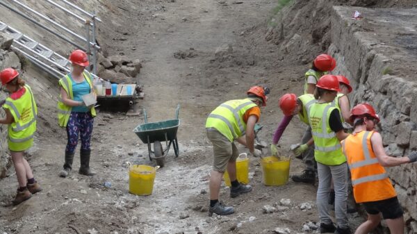
Volunteers working on the restoration of the Stover Canal

Restoring waterways

Bringing Britain’s blue infrastructure back to life is good for people and places.