account arrow-down arrow-left arrow-right closecontact-us emailFacebookheart instagramjoin linkedin phonepinterestplaysearch twitteryoutube

Chelmer & Blackwater Navigation Walk

Walk the length of the 14 mile Chelmer & Blackwater and learn the history of the Navigation.

Walk

Location

Chelmer & Blackwater Navigation

Distance

22.5km (14 miles)

Ease

Challenging

activity image

The towpath is easy to follow along the length of the Navigation, and obvious where it changes from one bank to the other. Many other rights-of-way link with the towpath, giving endless opportunities for round walks of any length.

This walk indicates the points of interest along the Navigation. It starts at the head of the Navigation in Chelmsford, and runs downstream to Heybridge Basin.


Walk details

Surface

Much of the towpath has been upgraded although it can become muddy in wet weather. We recommend wearing wellies in winter.

Parking

There is plenty of public parking in Chelmsford City centre, and a large public car park at Heybridge Basin.

Chelmer & Blackwater Navigation Walk Map

Find directions to the Activity

Begin The Walk

1. Springfield Basin

Start your walk at Springfield Basin. The Basin is a stone’s throw from Chelmsford’s city centre.  Springfield’s population expanded, partly as a result of the coming of the Navigation, from 889 in 1801 to 2,256 in 1841.  Industries grew up around the Basin dealing in coal, coke, lime burning, timber and malting.  Richard Coates, Resident Engineer on the Chelmer and Blackwater Navigation, founded a coal and timber business which later became Brown & Sons.  He was also instrumental in founding Chelmsford’s first gas works on the wharf in 1819. Brown & Sons was taken over by the one of the firms that eventually merged to form Travis Perkins in 1988.

You will need to leave the Navigation when you reach Travis Perkins. Turn left until you get to Navigation Road, then turn right, and then right again at the first footpath you come to, when Travis Perkins’ yard finishes. From here, you will get to the water’s edge and can follow the towpath along to Springfield Lock.

2. Springfield Bridge and Lock

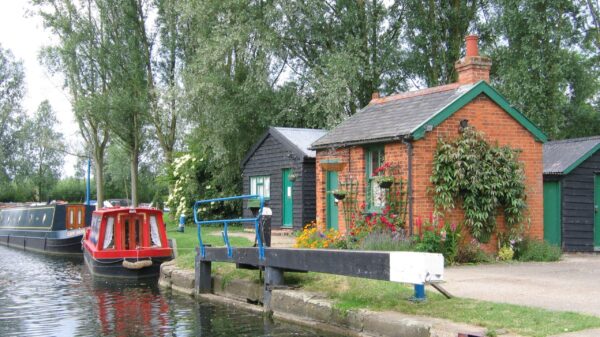
At the lock, you will see the original bridge from the 1790s. Just below the lock the navigation joins the river Chelmer proper.  Ahead, across the broad flood plain, you will be able to see the original Chelmsford bypass, opened in 1932.

3. Barnes Mill Lock

Continue along the towpath until you reach the next lock.

Below the lock you can see a late eighteenth century weather boarded mill. For much of its life it was tenanted and worked by the Marriages, a well-known local milling and farming family, connected with the Navigation from its earliest days.

4. Sandford Mill

Continue walking along the towpath until you reach Sandford Mill. Here the Navigation takes an artificial cut to bypass the site of the Mill.  The original mill here had four pairs of stones.  In 1880, additional power was provided by steam and in 1884 1,596 quarters of waterborne wheat were ground here.  Gradually the mill decreased its output until it was bought by Chelmsford Borough Council in 1924 for the site of its water works, now closed.  It awaits a new use.

5. Cuton Lock and Stonham’s Lock

Passing under the A12 dual carriage way, the next lock you will reach is Cuton Lock, followed by Stonham’s Lock. Between these two locks there is a good view of Danbury Hill.  The highest part, 365 feet above sea level, is crowned by a spired church.

6. Little Baddow Lock

Continue along the path until you reach Little Baddow Lock.

To the right is the site of Johnson’s, alias Little Baddow, Mill.  This was burned down in 1893 and the site was later acquired by the Navigation Company who rebuilt the present mill-house.  Below the lock and beyond Boreham Bridge, rebuilt in the 1950s, there is a good view of Little Baddow church dating mainly from the twelfth, fourteenth and fifteenth centuries.

When you reach Boreham Bridge, you will need to cross over the Navigation to continue following the path.

7. Paper Mill Lock

Paper Mill Lock is the base for Essex Waterways Ltd and the hub of the Navigation.

This marked the ‘half way house’ along the Navigation in barging days.  On the right of the lock are the stables, now tea rooms, where the horses spent the night and on the left is the restored early twentieth century brick bothy, where the bargees slept, now the Navigation office.  In 1792 there were two mills on the island to the left just below the lock.  One mill was engaged in grinding corn and the other in making paper.  Paper making seems to have been started by John Livermore in the late eighteenth century.  A mill stood on the site until the early years of the 20th century.

8. Rushes Lock

The next lock along the route is Rushes Lock. Beyond the lock can be seen the thirteenth century church of Ulting, which was restored in 1873.

9. Hoe Mill Lock

You will arrive at another lock with moored boats and a camping and caravan site.

The lock is contained in an artificial cut which bypassed the mill that possessed two wheels and 12 pairs of stones.  It was worked until 1895 and was finally pulled down about 1914.

Four hundred yards below the lock is Sugar Baker’s Holes.  This was the site in the early 1830s of Marriage, Ried and Marriage’s beet sugar works, one of the earliest in the country.

10. Rickett’s Lock & Bridge

This is another of the original red brick bridges built in the 1790s. Just below the lock can be seen Langford Waterworks which takes up to 35 million gallons of water daily from the Navigation.

11. Beeleigh Lock

Beeleigh Lock is contained in an artificial cut, which joins together the Chelmer and Blackwater rivers to form the Navigation.

Beyond the lock, the excess water from the Blackwater flows over the Long Weir into the tidal reach of the river Chelmer.  At this point the Navigation enters the river Blackwater.

Beeleigh Bridge, built in the 1790s, now takes traffic from Langford to Maldon Golf Course, laid out in 1891.  A good view of Maldon can be obtained from here. Immediately beyond the bridge, the former Langford Canal, built in 1792, which served Langford Mill goes off to the left.  Its disused southern section can be seen making its way across the golf course to the right.

12. Chapman’s Bridge

This is the last of the original brick bridges you will see on the Navigation. Just beyond it is the Maldon Bypass bridge, built on the site of a railway viaduct that was built in 1889 to join the Maldon East and Maldon West stations.

13. Heybridge

Beyond the second Bypass bridge, which was also the site of a former railway bridge, a backwater leads off to the right to the site of Heybridge Mill (demolished 1954).

At this point the Navigation leaves the river Blackwater and enters its longest artificial cut which goes through Heybridge to the Basin. Heybridge developed enormously after the opening of the Navigation especially with the siting in about 1811 of William Bentall’s iron works beside the Navigation where iron ore, coal and timber could be easily imported.  The business prospered and Heybridge grew from 368 people in 1801 to 1177 in 1841.  By 1900 the works covered 13.25 acres.  At the beginning of the straight cut, beyond Wave Bridge, is Bentall’s warehouse built in 1863 and now a scheduled industrial monument.

14. Heybridge Basin

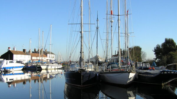
Heybridge Basin links the Chelmer & Blackwater Navigation to the Blackwater Estuary via a tidal sea lock.

No settlement existed here until the 1790s.  As sea and Navigation trade increased, so the hamlet expanded.  The cottages adjacent to the Basin, date from the 1790s and the Old Ship, formerly the Chelmer Brig, was rebuilt in 1858.  The Lockkeeper’s House was built in 1842 and the pair of old cottages nearby date from the 1820s.

The basin could accommodate ships of 300 tons which once brought coal from Newcastle and timber from Scandinavia.

Explore more nearby

Related activities

Waterway underfunding

Hundreds of miles of waterways – along with their unique heritage and habitats – are currently starved of funding and rely on constant lobbying by us to safeguard their future.

Sustainable Boating

We want boating on canals and rivers to be more sustainable and – even though the current overall contribution to UK carbon emissions is very small – we want to help reduce emissions on the waterways.

Waterways Heritage at Risk

Britain’s canals and rivers are a unique, living heritage. But that heritage is at risk – from urban development, lack of protection, loss of skills and knowledge and climate change.

You can help Save Waterways Heritage.

Waterway restoration

Restoring the UK’s blue infrastructure – our inherited network of navigable canals and rivers – is good for people and places.