account arrow-down arrow-left arrow-right closecontact-us emailFacebookheart instagramjoin linkedin phonepinterestplaysearch twitteryoutube

Bridgewater Canal

The Bridgewater Canal runs from Castlefield Junction with the Rochdale Canal, in Manchester, to its terminus in Runcorn, with two arms: the Leigh Arm and the Preston Brook Branch.

Map of the Bridgewater Canal and surrounding waterways

Facts & Stats

39.1 miles

(62.9 km)

The length of the Bridgewater canal that is navigable. The main line of the canal is 28.1 miles (45.2 km).

0 locks

Across the two arms and the main line of the canal there are no locks

From Manchester to Runcorn

The Leigh Arm is 10.8 miles and runs from Waters Meeting in Stretford to the Leigh Arm of the Leeds & Liverpool Canal in Leigh. The Preston Brook Branch is just 0.8 miles and connects to Trent & Mersey Canal. 

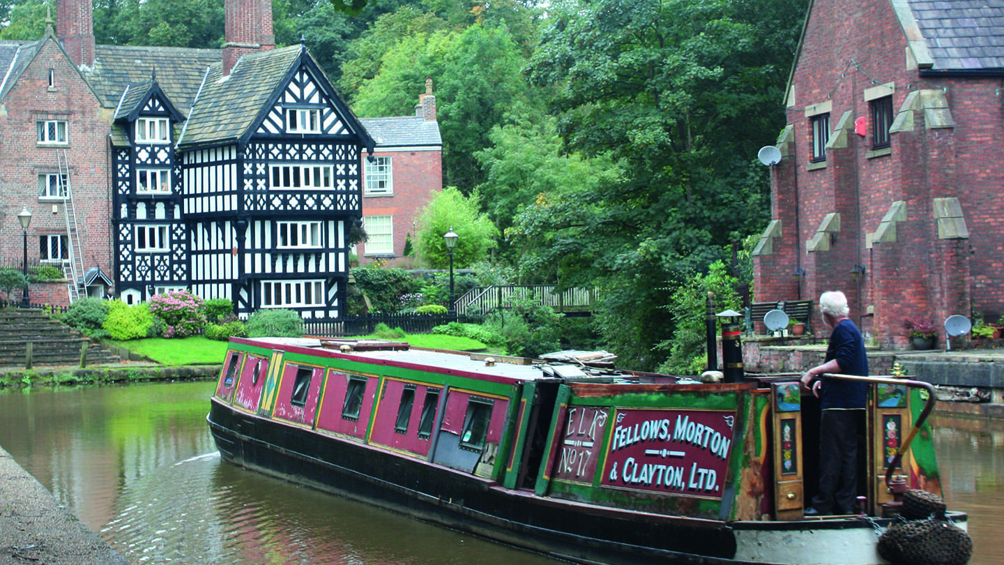
The Bridgewater Canal is famous for being the first built for the Duke of Bridgewater to take coal from his mines at Worsley, where there were more than 40 miles of underground canals on more than one level. 

Waterway notes

Maximum boat sizes

  • Length: There are no locks to limit length
  • Beam: 14′ 9″ (4.5 metres)
  • Height – Leigh Branch: 8′ 6″ (2.6 metres); Height – main line: 11′ (3.4 metres)
  • Draught: 5′ (1.5 metres)

Branch

IWA Chester & Merseyside Branch – Preston Brook to Lymm and to Runcorn (including former Runcorn Locks)


IWA Manchester Branch – Hulme Lock Branch and Pomona Lock Link; Leigh Arm of Leeds and Liverpool to Waters Meeting (Stretford); Rochdale Canal to Waters Meeting (Stretford); Waters Meeting (Stretford) to the M6 Road Bridge at Lymm.

Useful Info

There is also a short spur link to the Manchester Ship Canal via Pomona Lock, 1.2 miles from Castlefield Junction.

HS2: Bridgewater Canal

The Bridgewater Canal is a heritage asset of national importance, being the first major canal built in England by the pioneering engineer James Brindley, which played a significant part in enabling the industrial revolution. This section of the canal was completed by 1769 and its bridges, aqueducts, warehouses and other structures remain largely as built.

Sustainable Boating

We want boating on canals and rivers to be more sustainable and – even though the current overall contribution to UK carbon emissions is very small – we want to help reduce emissions on the waterways.

Waterways Heritage at Risk

Britain’s canals and rivers are a unique, living heritage. But that heritage is at risk – from urban development, lack of protection, loss of skills and knowledge and climate change.

You can help Save Waterways Heritage.

Waterway restoration

Restoring the UK’s blue infrastructure – our inherited network of navigable canals and rivers – is good for people and places.

Waterway underfunding

Hundreds of miles of waterways – along with their unique heritage and habitats – are currently starved of funding and rely on constant lobbying by us to safeguard their future.

Sustainable Boating

We want boating on canals and rivers to be more sustainable and – even though the current overall contribution to UK carbon emissions is very small – we want to help reduce emissions on the waterways.

Waterways Heritage at Risk

Britain’s canals and rivers are a unique, living heritage. But that heritage is at risk – from urban development, lack of protection, loss of skills and knowledge and climate change.

You can help Save Waterways Heritage.

Waterway restoration

Restoring the UK’s blue infrastructure – our inherited network of navigable canals and rivers – is good for people and places.

Local activities