account arrow-down arrow-left arrow-right closecontact-us emailFacebookheart instagramjoin linkedin phonepinterestplaysearch twitteryoutube

Worcester & Birmingham Canal

The Worcester & Birmingham Canal runs from the River Severn in Worcester to the Birmingham Canal at Worcester Bar. 

Map showing the Worcester & Birmingham Canal

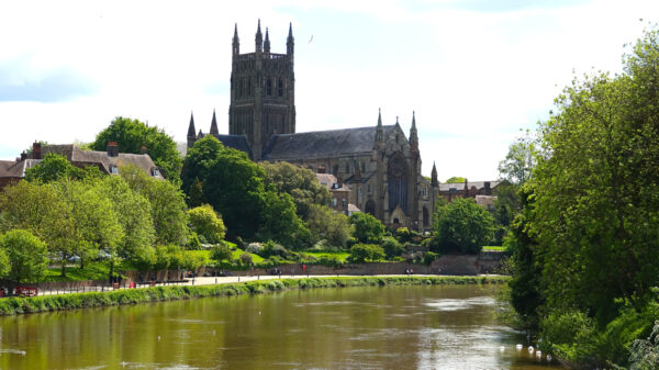
Worcester Cathdral overlooking the River Severn

Facts & Stats

30 miles

(48.3km)

The length of the Worcester & Birmingham Canal.


58 locks

The 58 locks include the 30 Tardebigge locks, the longest continuous flight in the UK.

1815

Year completed

From the River Severn to the Birmingham Canal

The first Act to promote the Canal was passed in 1791 but it took until 1815 for the canal to be completed, when the Bar Lock was built in Worcester Bar at Gas Street Basin. Previously, the Birmingham Canal Navigation had insisted on a physical barrier to preserve its water, across which all cargoes had to be transhipped. This bar meant the Worcester and Birmingham Canal Company had to provide its own reservoirs, rather than relying on water flowing down from the Birmingham Canal.

Although intended as a broad canal for barges, and having five broad tunnels, it was eventually completed with narrow locks due to financial constraints. From Gas Street Basin at the Birmingham end, it passes through the suburbs of Edgbaston, Selly Oak and Kings Norton, then through the long Wast Hill Tunnel, and via Hopwood and Alvechurch through countryside to Tardebigge. Then, it descends in stages via fifty-six narrow locks and two barge locks to the River Severn at Diglis via Stoke Prior, Hanbury Wharf, Dunhampstead, Tibberton, Blackpole and the eastern suburbs of Worcester City.

At Tardebigge, there is a plaque commemorating the meeting between Rolt and Aickman in 1946, which led to the waterways’ revival and the founding of The Inland Waterways Association.  There is also a subsequent plaque correcting the year of the meeting to 1945.  IWA was then formed in early 1946.


Waterway notes

maximum boat sizes

  • Length: 74′ 11″ (22.85 metres) – lock 6
  • Beam: 7′ 3″ (2.21 metres) – lock 3
  • Headroom: 8′ 2″ (2.5 metres) – bridge 86
  • Draught: 3′ 8″ (1.1 metres) – bridge 4

Navigation authority

Waterway underfunding

Hundreds of miles of waterways – along with their unique heritage and habitats – are currently starved of funding and rely on constant lobbying by us to safeguard their future.

Sustainable Boating

We want boating on canals and rivers to be more sustainable and – even though the current overall contribution to UK carbon emissions is very small – we want to help reduce emissions on the waterways.

Waterways Heritage at Risk

Britain’s canals and rivers are a unique, living heritage. But that heritage is at risk – from urban development, lack of protection, loss of skills and knowledge and climate change.

You can help Save Waterways Heritage.

Waterway restoration

Restoring the UK’s blue infrastructure – our inherited network of navigable canals and rivers – is good for people and places.

Local activities