account arrow-down arrow-left arrow-right closecontact-us emailFacebookheart instagramjoin linkedin phonepinterestplaysearch twitteryoutube

River Rother (East Sussex)

The River Rother is navigable from Bodiam to the sea at Rye Harbour. 

Map showing the River Rother

Facts & Stats

1

lock

16.5miles

(26.5 km)

The length of the River Rother (Eastern) that is navigable.

From Bodiam to Rye Harbour

The river rises at Rotherfield, and flows into the sea at Rye Harbour the total length is about 35 miles. It is almost all in East Sussex; for some way it forms the boundary with Kent, and a small stretch is in Kent.  It is referred to properly as the Eastern Rother, as opposed to the River Rother in Hampshire and West Sussex.  Locals refer to it as the Rother, and the use of the term “Eastern Rother” locally is likely to cause confusion.

Navigation for vessels such as cruisers is limited to the 12 mile stretch between Bodiam and the lock known as Scott’s Float, a mile or two above Rye, below which the river is tidal.  Scots Float Sluice is only available for operation on limited number of days each year, and needs to be booked with the Environment Agency (03708 506506 – [email protected]) giving five days’ notice.  There is a large slipway just upstream of the lock.  The Environment Agency own this slipway and now say that it is not usually available for public use.  It used to be open the public at 24-hours notice for a charge.

There is information about the tidal section on the Rye Harbour Boat Owners Association’s website and at the Environment Agency’s gov.uk pages.  The Agency is Navigation Authority for Rye Harbour.

Canoes and similar may be able to penetrate upstream of Bodiam.

The following notes cover the non-tidal stretch between Bodiam and Scott’s Float.

There are a number of tributaries, which are generally very shallow and navigation on them is not recommended. The straight stretch above Scott’s Float leads to the junction with the Royal Military Canal. The canal continues the line of the river.  Iden Lock, which begins the canal, is not navigable.  The navigable river turns sharply north-westward at this point; from here the river has no sharp bends.

The River is managed by the Environment Agency, whose principal responsibility is water management. There is no licence: navigation is free. There is no formal requirement for insurance. Parts of the river, especially at Newenden, can be busy in summer with users ranging from swimmers and paddleboarders to powered craft.

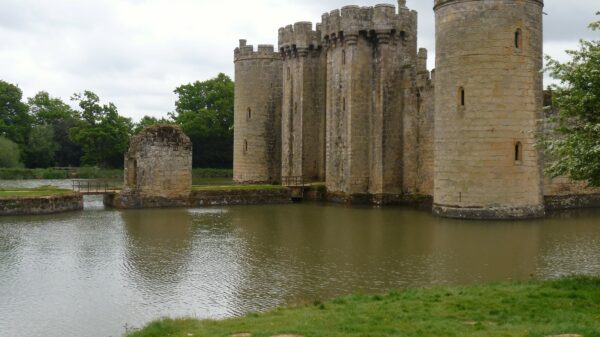
The levels on the non-tidal stretch fluctuate very considerably, especially in winter, and most boaters avoid this time.  Indeed most boats are removed over winter.

Moorings exist at Newenden and Northiam (the river is the boundary of the villages, and also the county boundary Kent and East Sussex).  On the Kent bank, they are managed by the Parish Council, on behalf of the Selmes Trust.  On the East Sussex bank, the moorings are administered by Gardenscape,  whose offices are on the north bank.

The Bodiam Boating Station is located on the south side of the river at Newenden Bridge, about two miles north of Northiam, and NOT in Bodiam; it uses the name for historical reasons.  It has a large jetty, but not a slipway. Instead it offers a boat cranage service in early October and late March, when it hires in a mobile crane to lift boats out to their trailers.  It offers (small) boat hire and runs a trip boat in summer.

There are moorings just downstream of New Bridge on the B2082 road from Playden to Wittersham, about 1 mile north of the village of Iden. They can be approached via a path on the north side of the river, downstream of the bridge. This is the farm at the side of the entrance path.  There are movable pontoons, and boats  overwinter there.

There are moorings in the straight stretch just below the junction with the Military Canal.

There are a few boats in the lower section.

[Compiled from notes by the late Malcolm Jones.  Photo, from below Scots Float Sluice by Robin Stephens]

Waterway notes

Maximum boat sizes

  • Length: 49′ (15 metres)
  • Beam: 13′ (4 metres)
  • Height: 6′ 2″ (1.87 metres)
  • Draught: 3′ (0.9 metres)

Navigation authority

Environment Agency

Waterway underfunding

Hundreds of miles of waterways – along with their unique heritage and habitats – are currently starved of funding and rely on constant lobbying by us to safeguard their future.

Sustainable Boating

We want boating on canals and rivers to be more sustainable and – even though the current overall contribution to UK carbon emissions is very small – we want to help reduce emissions on the waterways.

Waterways Heritage at Risk

Britain’s canals and rivers are a unique, living heritage. But that heritage is at risk – from urban development, lack of protection, loss of skills and knowledge and climate change.

You can help Save Waterways Heritage.

Waterway restoration

Restoring the UK’s blue infrastructure – our inherited network of navigable canals and rivers – is good for people and places.

Local activities