Waterways > Black Sluice Navigation
Black Sluice Navigation
Black Sluice BNavigation connects to the tidal River Witham (‘The Haven’) in Boston, and is navigable as far as Donnington Bridge. There are plans to improve navigation beyond here and to connect up to the River Glen as part of plans for the Boston to Peterborough Fenland Link.
Map showing Black Sluice Navigation
Facts & Stats
19miles
(31 km)
Length of navigable drain
1 lock
Black Sluice Lock – in Boston
2009
Date the waterway opened
Waterway notes
Maximum Boat Sizes
- Length: 70′ (21.0 metres) – Black Sluice Lock
- Beam: 20′ (6 metres) – Black Sluice Lock
- Height: 11′ (3.4 metres) – London Road Bridge
- Height 10′ (3 metres) – Bridges further along the Navigation
- Draught: From 9′ (2.8 metres) at Boston to increasingly shallow towards the south and River Glen.
IWA Branch
Navigation Authority
Navigation Notes
Access to Black Sluice Navigation from the River Witham is via Grand Sluice (Sea Lock) to Boston Haven (the tidal Witham). This lock can only fit boats up to 41′ (12.5 m) in length, but longer boats can pass through ‘on the level’ when the tidal water in The Haven reaches the same height as the non-tidal water in the Witham Navigation. This Canal & River Trust operated lock is manned (VHF channel 74 during tidal operations).
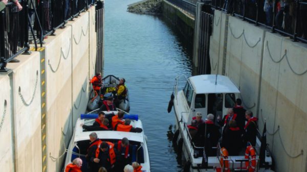
Black Sluice Navigation, also known as the South Forty Foot Drain, is an artificial drainage river in Lincolnshire. Unused for nearly 40 years, the waterway was re-opened to visiting boats in 2009. It’s a typical Fen drain, providing 19 miles (31km) of navigation to the west of Boston in Lincolnshire.
The first lock here was part of the first attempt by the Earl of Lindsey to drain the surrounding levels in 1635. It is thought that the name derives from the battle that destroyed the original sluice. The current structure dates from 2008 and was built as part of the Fens Waterways Link scheme. There are aspirations to link the southern end of the Navigation and South Forty Foot Drain to the River Glen as part of establishing a navigable link between Boston and Peterborough. Beyond Donnington Bridge, access is only possible for small unpowered boats, such as canoes and kayaks. This is due to restricted water depth, headroom, width and environmental considerations.
Waterway underfunding
Hundreds of miles of waterways – along with their unique heritage and habitats – are currently starved of funding and rely on constant lobbying by us to safeguard their future.
Sustainable Boating
We want boating on canals and rivers to be more sustainable and – even though the current overall contribution to UK carbon emissions is very small – we want to help reduce emissions on the waterways.
Waterways Heritage at Risk
Britain’s canals and rivers are a unique, living heritage. But that heritage is at risk – from urban development, lack of protection, loss of skills and knowledge and climate change.
You can help Save Waterways Heritage.
Waterway restoration
Restoring the UK’s blue infrastructure – our inherited network of navigable canals and rivers – is good for people and places.
Join us as a member
Help protect and restore the waterways you love.


